
Sightseeing
Discover some of Santo Antão’s most remarkable mountain, valley and coastal landscapes in a single day. Travel through the volcanic highlands of Cova, stop above the dramatic Ribeira da Torre, explore Ponta do Sol and Fontainhas, and finish among the sugarcane terraces and tropical vegetation of Paul Valley, with a taste of one of the island’s best-known local products along the way.
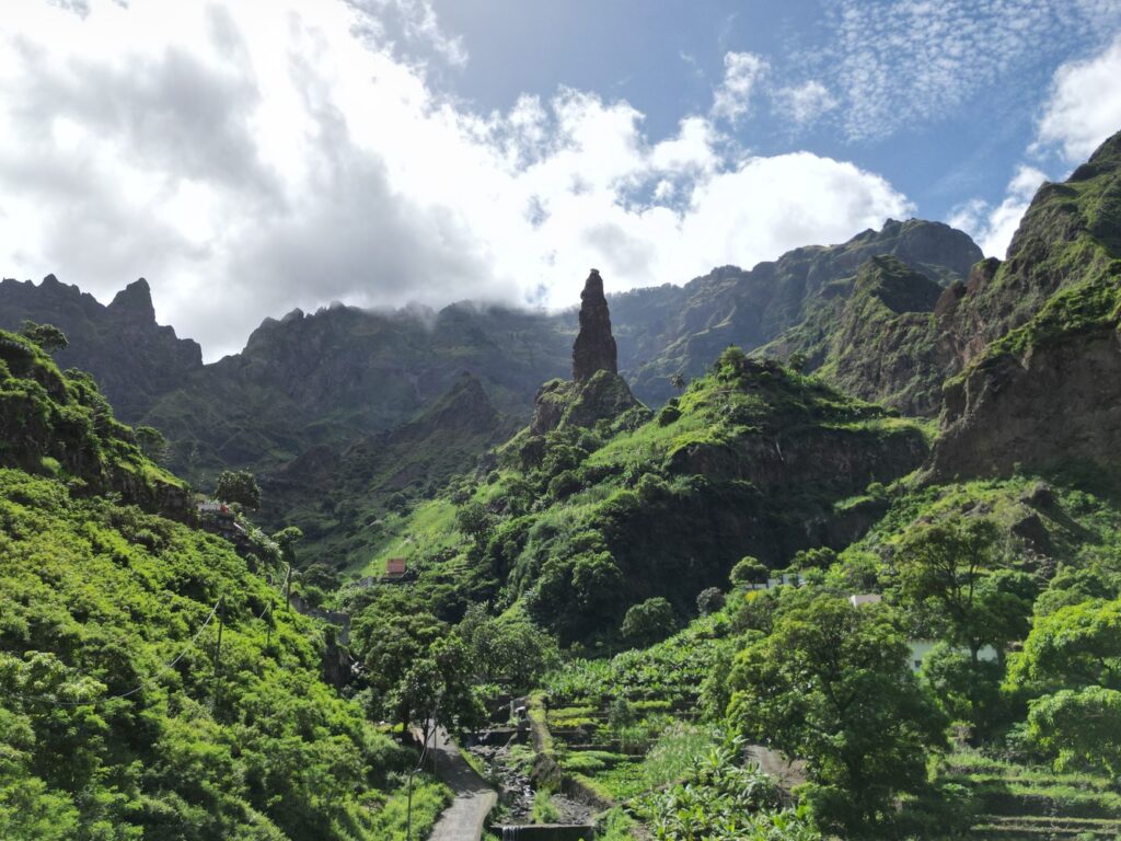
After pickup from your accommodation, the journey begins towards Santo Antão's mountainous interior.
The change in landscape is part of the experience. Roads leave the lower, drier parts of the island and climb towards higher ground, where volcanic slopes give way to cultivated terraces, pine-covered areas and increasingly deep valleys.
Rather than simply transporting you between attractions, this first section introduces one of the defining features of Santo Antão: dramatic changes in altitude and vegetation over relatively short distances.
There will be opportunities to stop as the landscape opens below the road.
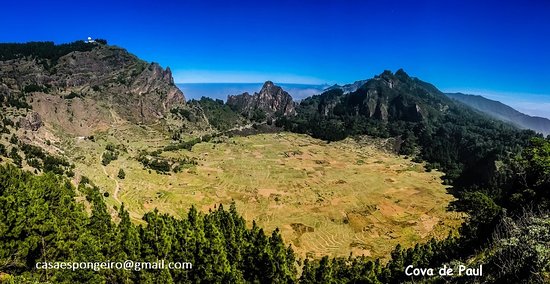
The first major stop is Cova, a broad volcanic crater high in Santo Antão's interior.
What was created by volcanic activity is now also an agricultural landscape. Crops are cultivated inside the crater, surrounded by steep slopes and mountain vegetation. The contrast between the almost geometric cultivated plots below and the volcanic walls around them gives Cova a character quite different from the coastal landscapes seen later in the day.
A short walk around the viewpoint allows time to appreciate the scale of the crater and the cooler highland environment.
Cova is also the starting point of one of Santo Antão's best-known walking routes, descending towards Paul Valley. The local tourism authority places the viewpoint at about 1,170 metres and describes the crater as roughly one kilometre across.
For this tour, however, you continue by vehicle. No major hike is required.
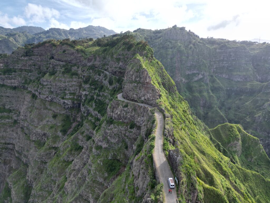
The journey continues along the historic mountain road commonly known as the Estrada da Corda.
Here the road itself becomes part of the day.
It follows the contours of Santo Antão's highlands through tight bends and exposed ridges, with valleys falling away on either side. Around Delgadinho the landscape becomes especially dramatic: steep mountains, narrow ridgelines and cultivated valleys reveal just how deeply erosion has reshaped the volcanic island.
Rather than a single attraction that you enter and leave, this section is a sequence of changing perspectives.
There is time for photographs, but the interest comes from watching the geography unfold as the road moves from the central highlands towards the greener north.
From the highlands, the route descends towards Ribeira da Torre, one of Santo Antão's major cultivated valleys.
High rock walls frame agricultural terraces and small settlements below. Banana plants, sugarcane, vegetables and fruit trees occupy the areas where water and fertile soil allow cultivation, producing one of the strongest contrasts of the day with the dry landscapes found elsewhere on the island.
The valley is not presented as a viewpoint alone.
It is a lived agricultural landscape.
Short stops allow you to see how houses, roads and cultivated land fit into terrain that initially seems almost too steep to inhabit. The wider Cova, Ribeira da Torre and Paul area is protected as a natural park covering all three municipalities of Santo Antão.
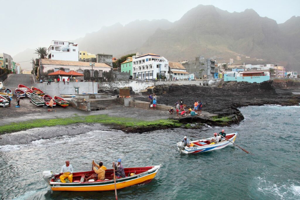
The mountains eventually give way to the Atlantic at Ponta do Sol.
Once an important port, the town still has a strong relationship with fishing and the sea. Small boats, the harbour and compact streets provide a very different setting after the high mountain roads and inland valleys.
There is time for a short walk through the centre and waterfront.
Ponta do Sol also sits at the beginning of one of Santo Antão's best-known coastal walking routes, which continues towards Fontainhas and eventually Cruzinha.
On this tour, it serves another purpose: a chance to see how closely mountains and ocean meet on the northern side of Santo Antão.
From Ponta do Sol, a narrow mountain road climbs towards Fontainhas.
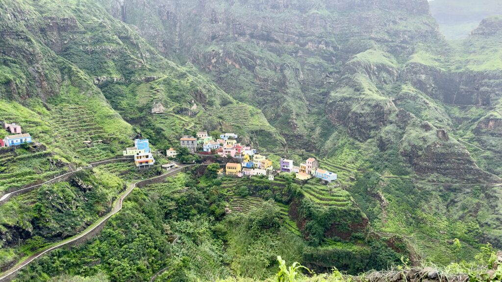
The village occupies a steep mountainside above deep valleys and the Atlantic, with colourful houses scattered across a landscape where very little ground appears flat.
The drive is short, but the setting changes quickly.
At the viewpoint, the road, houses, terraced fields, mountain walls and ocean can all be seen within the same landscape. It is one of those places where Santo Antão's geography explains much of the architecture and daily life: settlements adapt to the mountain rather than the other way around.
The official Santo Antão tourism site describes Fontainhas as a village built high on the mountain, surrounded by deep valleys and overlooking the ocean.
There is time for photographs and a short walk before returning towards the main route.
Around the middle of the day, stop for lunch at a local restaurant.
This is deliberately not treated as a rushed refuelling stop between viewpoints. Cape Verdean food is part of the island experience, and Santo Antão's agricultural valleys supply ingredients that appear in local kitchens across the island.
Depending on the restaurant and season, the menu may include fresh fish, meat, vegetables, beans, maize or other Cape Verdean dishes.
Prix selon le nombre de participants